ENAIRE increases its ability to monitor satellite signals to serve Spanish air navigation and airports

ENAIRE, Spain's air navigation service provider, continues to increase its ability to monitor satellite signals to serve Spanish air navigation and airports.
Satellite navigation systems, also known as GNSS systems, are increasingly used in air navigation as the main sensor in PBN, or performance-based navigation.
GNSS systems provide precision positioning in their service area. Both global positioning (GPS, Galileo, GLONASS) and augmentation (ABAS, SBAS and GBAS) systems are regarded as GNSS systems. Positioning systems provide the radio signals needed to unequivocally identify the time, position (latitude, longitude, altitude) and speed of the receiver.
Currently, the use of signals from a global constellation (GPS) and from the three types of augmentation (ABAS, SBAS through the European EGNOS system, and a GBAS operating system operated by ENAIRE at the Málaga-Costa del Sol Airport) is authorized in Spain for civil aviation.
ENAIRE monitors GNSS signals as per the recommendations of the International Civil Aviation Organization (ICAO), the requirements of the European Commission and the European Aviation Safety Agency (EASA), and the requirements of the Civil Aviation General Directorate (DGAC) and the National Aviation Safety Agency (AESA), within the framework of the group to implement PBN procedures in Spain.
Specifically, a number of activities are currently underway to monitor, analyze and report to the relevant authorities any anomalies in GNSS signals (GPS/RAIM, GBAS and EGNOS) used in Spanish airspace.
ENAIRE is also working on research, development and innovation (R&D&I) and standardization projects to lay the groundwork for the systems that will be used in the future, such as the inclusion of the Galileo European constellation, and the use of multifrequency (L1/E1 and L5/E5)/multiconstellation (GPS and Galileo) receivers.
At the European level, GNSS monitoring tasks are also being promoted through various initiatives, such as the creation of a concept of operations (European GNSS Monitoring Concept Of Operations) by the European Union Agency for the Space Program (EUSPA) to share this information with different stakeholders in aviation.

RECNET monitoring system
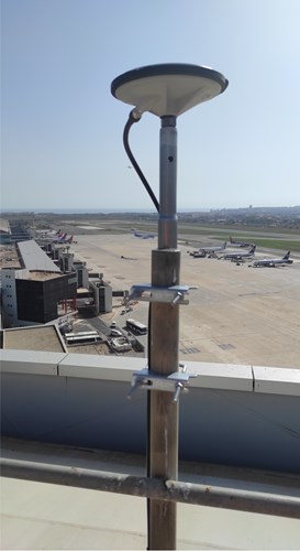
ENAIRE currently has two systems for monitoring performance and identifying interference. One of these systems is wide-area, known as RECNET, which covers numerous airports throughout Spain with GNSS maneuvers and can be used to monitor performance and detect interference.
Following the expansion of this system, ENAIRE now has a GNSS monitoring network consisting of 30 multi-constellation and multi-frequency stations.
DYLEMA monitoring system
The other monitoring system is called DYLEMA. It is specific to certain airports that are critical due to their traffic volume, and it is used to identify and locate in real-time any interference that may affect GNSS signals.
It should be noted that ENAIRE currently has an interference detection and location system at the Adolfo Suarez Madrid-Barajas Airport, which it is deploying at the Palma Airport. It will also be deploying it soon at the Josep Tarradellas Barcelona-El Prat Airport.


.png)


.jpg)

Comments
There are no comments yet for this item
Join the discussion