New geozoning ensures smarter organization of airspace around Dutch airports
- Amsterdam, The Netherlands.
From November 26, there will be more space to fly drones at a safe distance from airports. With the introduction of geozoning, different areas for flying drones are being designated within civil Control Zones (CTRs) around airports. This creates more opportunities for drone flights in locations where it is safe to do so.
Currently, drone flights within a Control Zone (CTR), the controlled airspace surrounding an airport, are only permitted under specific conditions and with the approval of air traffic control. This changes with the new geozoning. The new classification applies to the civil CTRs of Schiphol, Rotterdam The Hague Airport, Lelystad Airport, Maastricht Aachen Airport, and Groningen Airport Eelde. Nothing changes for military airports.
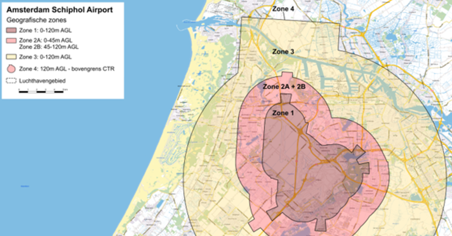
Within these areas, various zones will be established, with conditions corresponding with the risk to manned aviation. As a result, drone pilots can fly in certain zones without prior permission from air traffic control. Closer to airports and take-off and landing routes, stricter conditions will continue to apply. The new classification was developed by the Ministry of Infrastructure and Water Management and LVNL.
IMPORTANT STEP FOR THE INTEGRATION OF DRONES
Drones are increasingly being deployed for inspections and surveillance, as well as for societal tasks performed by the police, fire department, and customs, among others. As a result, the demand for space in the airspace is increasing.
Joost Meijs, CEO of LVNL: "The number of applications for drones is growing rapidly. Geozoning helps us to organize the airspace more intelligently, so that drones and manned aviation can operate safely alongside each other. With this, we are taking an important step in the further integration of drones into Dutch airspace, where safety always comes first."
The number of drone applications is growing rapidly. Geozoning helps us to organize airspace more intelligently, so that drones and manned aviation can operate safely alongside each other. In doing so, we are taking an important step in the further integration of drones into Dutch airspace, where safety always comes first.
Joost MeijsCEO LVNL
INSIGHT FOR DRONE OPERATORS
The new geozones will become visible in the GoDrone app on November 26. Drone operators can see there in which zone they are flying. For the rules and conditions applicable within a geozone, they can visit rijksoverheid.nl/drones . For areas where LVNL is responsible for air traffic control services, information regarding the conditions for flying there, such as submitting a mission plan and any necessary permission from air traffic control, can be found via LVNL and GoDrone.
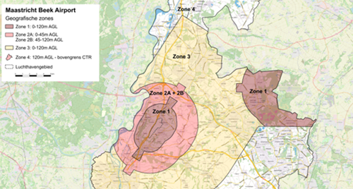
An example of the new geozones within the Maastricht-Aachen civil CTR below.





.jpg)
.png)





Comments
There are no comments yet for this item
Join the discussion